Large-Scale Maps & Projects Gallery
A sample of some large-scale projects completed using TNTmips
Forest Mapping in Chile
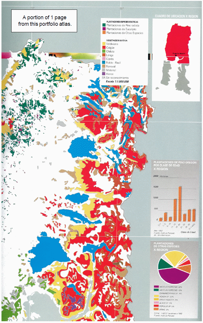
The Instituto Forestal and the Centro de Informacion de Rcursos Naturales in Santiago produced the Atlas Forestal de Chile, a 143-page portfolio sized book with 53 color forest maps of all of Chile at 1:500:000. The maps show vector polygons with generalized map feature overlays. Publication, CIREN-INFOR No. 103, 1994.
Geologic Maps of Japan
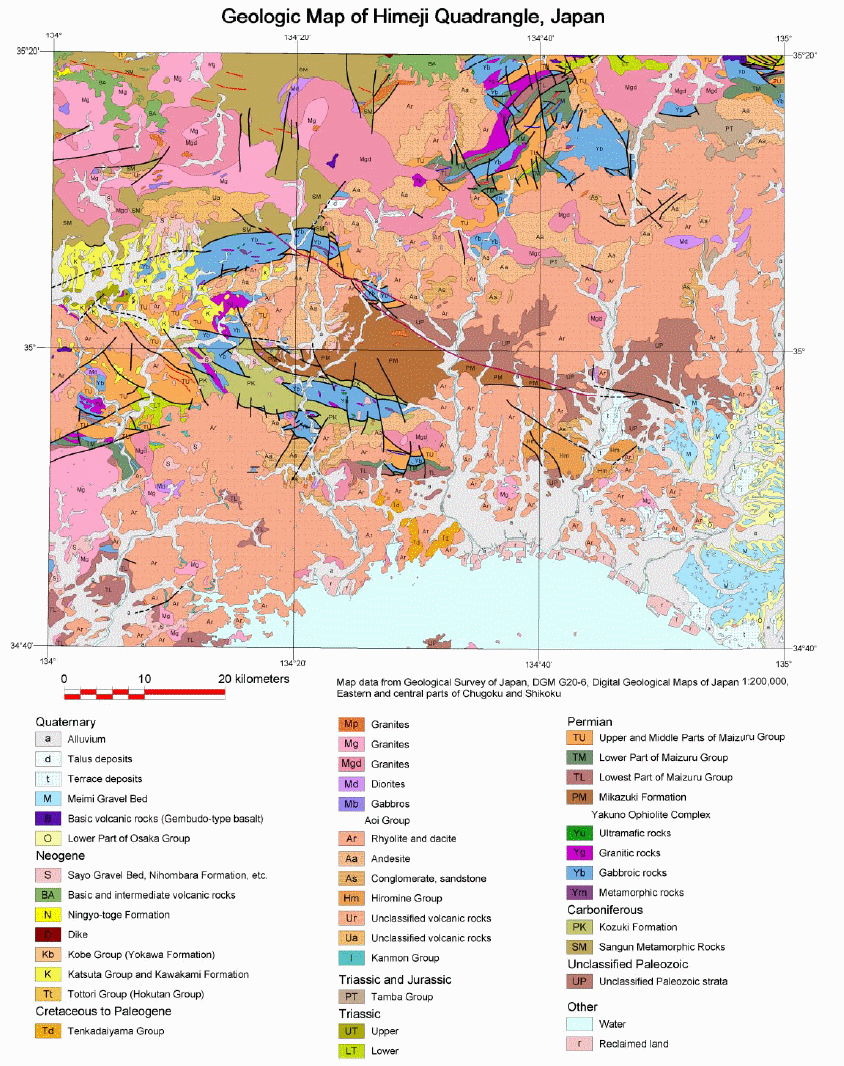
Geological Survey of Japan created 124 digital maps at 1:200,000. The maps are distributed on CD in files using the TNTgis native format as well as versions exported to ESRI shapefiles and USGS DLG files.Using TNTmips, the GSJ project team scanned paper geologic maps and converted to vector form, edited tabular content to reconcile all classification units to current schema, edited vector content to match at edges of individual maps, and added styles to map units, strike, dip and other special symbolism and Japanese and English labels.
Geologic Map of Southeast Asia
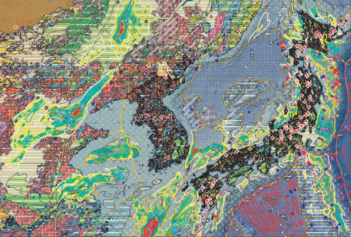
Ten member nations of the Coordinating Committee for Coastal and Offshore Geoscience Programmes in East and Southeast Asia (CCOP) digitized their available geologic maps by various means. Via technical committee meeting, these mapping units were unified. Using the expert services and support of the Geological Survey of Japan, these were assembled into vector layers in TNTmips and published as four 1:2,000,000 map sheets.
Geologic Maps of Afghanistan
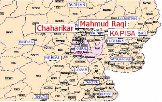
USGS, under the sponsorship of USAID, is using TNTmips to prepare data for ~250 reconnaissance-level, 1:100,000 digital geologic maps of Afghanistan. These will then be generalized into a 1:250,000 geologic map series for this nation. Extensive field work on this project is unrealistic due to mine fields, terrain, and human threats in this nation's remote mountainous areas. The USGS staff make extensive use of high resolution satellite imagery, image analysis, and 2D and 3D visualization techniques coupled with manual editing and map production techniques.
Hydrographic Maps at National Level
The following organizations each use TNTmips in the maintenance and production of their national hydrographic charts: United Kingdom Hydrographic Office, Law of the Sea Division; Japanese Maritime Safety Agency, and the Japanese Hydrographic and Oceanographic Department. This group reduced all the Japanese paper hydrographic charts to a base of Seamless Digital Hydrographic Data. The project used multiple TNTmips almost exclusively and was completed in 2 years.
Topographic Maps of Myanmar
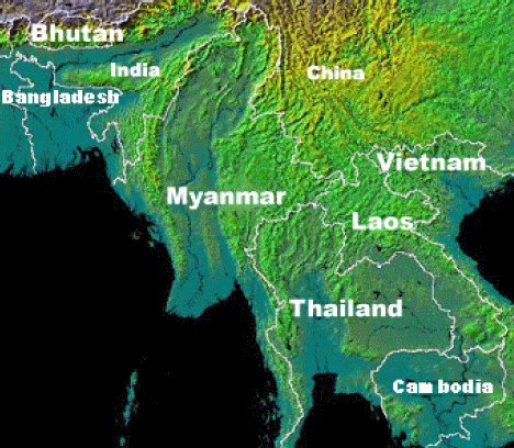
The national mapping agency used TNTmips to revise and publish 1700 1:50,000 topographic maps. Paper maps including contours were converted to digital line work. Line work was overlaid, corrected, and updated using ortho-satellite images and DEMs. New maps were prepared with required styles, legends, marginalia, and Burmese text and legends using the map layout process. File formats and separates were generated for large print presses. The maps are also used in digital form over secure networks.
Soil Maps of Turkey
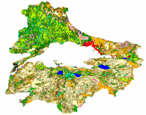
The Turkish General Directorate of Rural Services used TNTmips to convert 5560 1:25,000 soil maps covering the nation to digital form. This work was conducted in the Soil and Water Resources group of the National Information Center. Paper maps were scanned, rasters were converted and edited into vector form, maps were edited to reconcile edges, and vector maps were styled, labeled, and distributed with TNTatlas and TNTserver. Digital mapping data is also provided for sale separately.
Coastal Mapping in Bangladesh
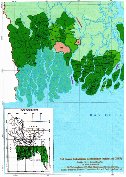
Kurushkul Polder Atlas of Bangladesh was prepared and published using TNTmips as part of a United Nations land protection/reclamation project. It was published in 11 x 17 inch printed color folio format containing 80 pages with 38 color coastal maps showing cultural and hydrologic features. Each coastal map was printed in TNTmips and accompanied by table plates to inventory these individual features. Satellite imagery and vector overlays were combined and interpreted in TNTmips with mapping layers that include Landsat TM imagery, political boundaries, and the coastal poulder project.
Highway Design Maps of Ankara, Turkey
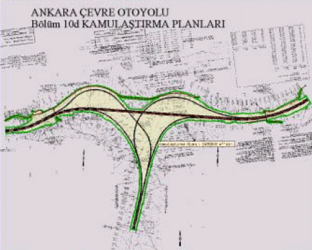
The Turkish General Directorate of Highways contracted for the reduction of 33,000 "as built" engineering design sheets to digital form using TNTmips. This project was contracted to HAT - Geographical Information Systems and Trade, Inc., a MicroImages independent Reseller in Turkey. It covers about 15% of the area of Turkey and was completed in 6 months. The as-built drawings, were scanned, digitized, assembled, and utilized in electronic form. Associated database information was prepared and attached.
Atlas of the Oder River Floodplain
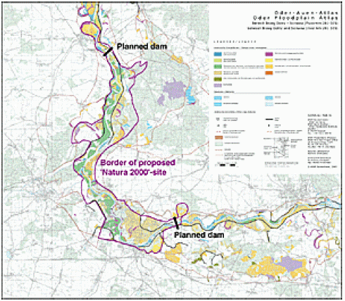
The Floodplains Institute of the World Wide Fund for Nature (WWF-Auen-Institut) in Rastatt used TNTmips to publish a large-format, high-quality folio atlas of the entire Oder/Odra floodplain from the Czech Republic downstream through Poland and Germany to the Baltic Sea. In 1996, WWF embarked on a project to prepare a baseline inventory of the natural floodplain infrastructures and biodiversity-relevant habitats and ecosystems. This was done in the context of emerging plans to develop the Oder/Odra river as a major navigation route.
GIS Information Assets of Maryland
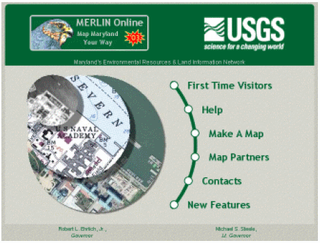
The Maryland Department of Natural Resources has used TNTmips to build a complete statewide GIS system of about 100 detailed map themes and images (see list attached). This Maryland Environmental Resources and Land Information Network (MERLIN) now uses this geodata totaling hundred of gigabytes. These GIS materials are published internally via the Department network and for public access via the Internet using TNTserver. The same materials are distributed free in county units as TNTatlases on CDs.
Gold Potential
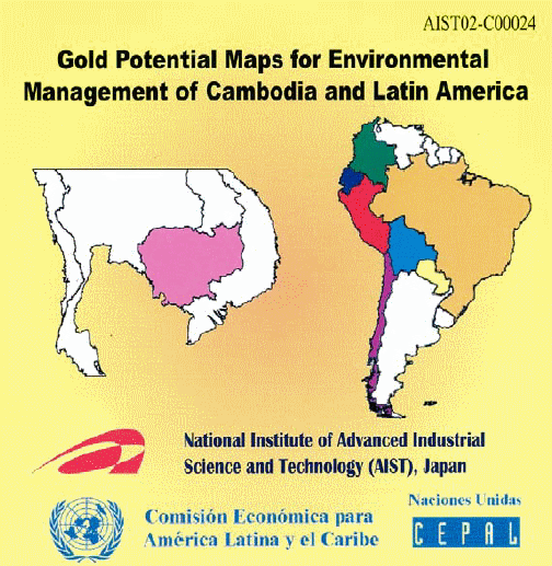
The United Nations Economic Commission for Latin America and the Carribean (CEPAL) worked with the National Institute of Advanced Industrial Science and Technology of Japan (AIST) using TNTmips to create atlases for environmental management related to gold exploration and extraction. The atlases are distributed on CD: Gold Potential Maps for Environmental Management of Cambodia and Latin America (Disc 1 Cambodia, Disc 2 Latin America).
Urban Geoscientific Data of East and Southeast Asia
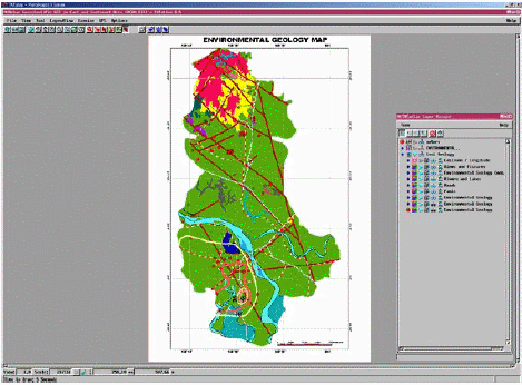
Member nations of the Coordinating Committee for Coastal and Offshore Geoscience Programmes in East and Southeast Asia (CCOP) cooperated in using TNTmips to construct digitized multi-layered data sets of large urban areas in East and Southeast Asia. The objective of this project was to cooperate to "construct digital multidisciplinary Geoscientific maps of CCOP regions, to transfer the technology to analyze multilayered data sets under the Geographical Information System (GIS), to develop the geoinformation service system for citizens".