Flexible LIDAR Layer Display
LIDAR points clouds containing millions of elevation points can be viewed as points (styled by class, elevation, or return type) or as a virtual terrain surface with relief shading, color by elevation, or both. Virtual terrain surfaces can be constructed on-the-fly using your choice of point classes. Examples are shown for an urban area. See the LAS Point Cloud Display Options and View LAS Point Cloud as Surface Technical Guides for more information.
LIDAR Points Styled
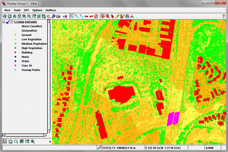
Display of classified LIDAR points with points styled using a different color for each point class.
Terrain Surface — Color-Coding
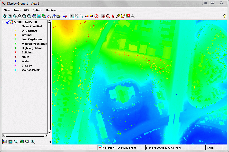
Virtual terrain surface from LIDAR points of all classes, shown with color-coding for elevation. The virtual surface includes buildings, trees, and a highway overpass.
Terrain Surface — Relief Shading
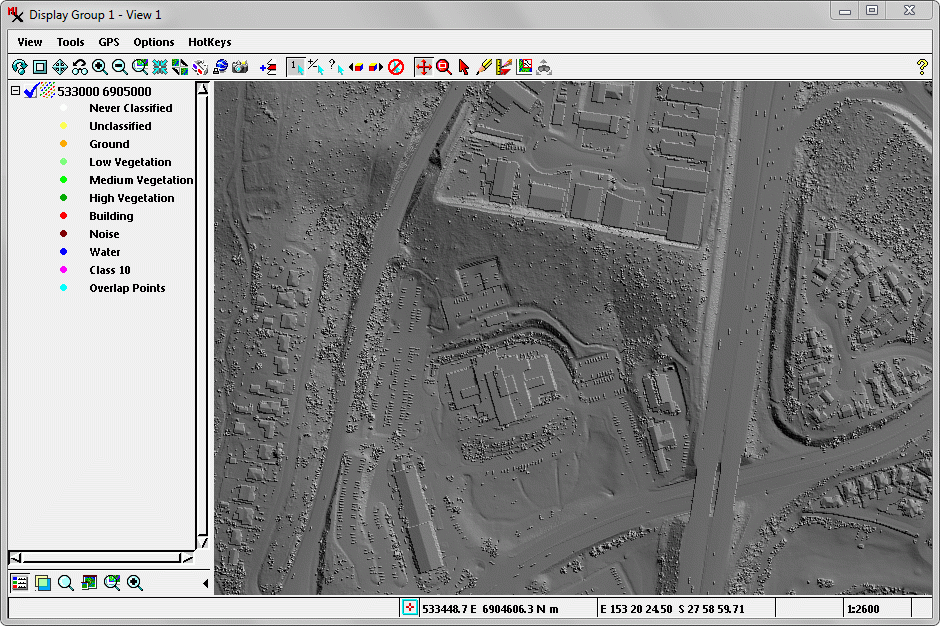
Virtual terrain surface from LIDAR points of all classes, shown with relief shading. The virtual surface includes buildings, trees, and a highway overpass.
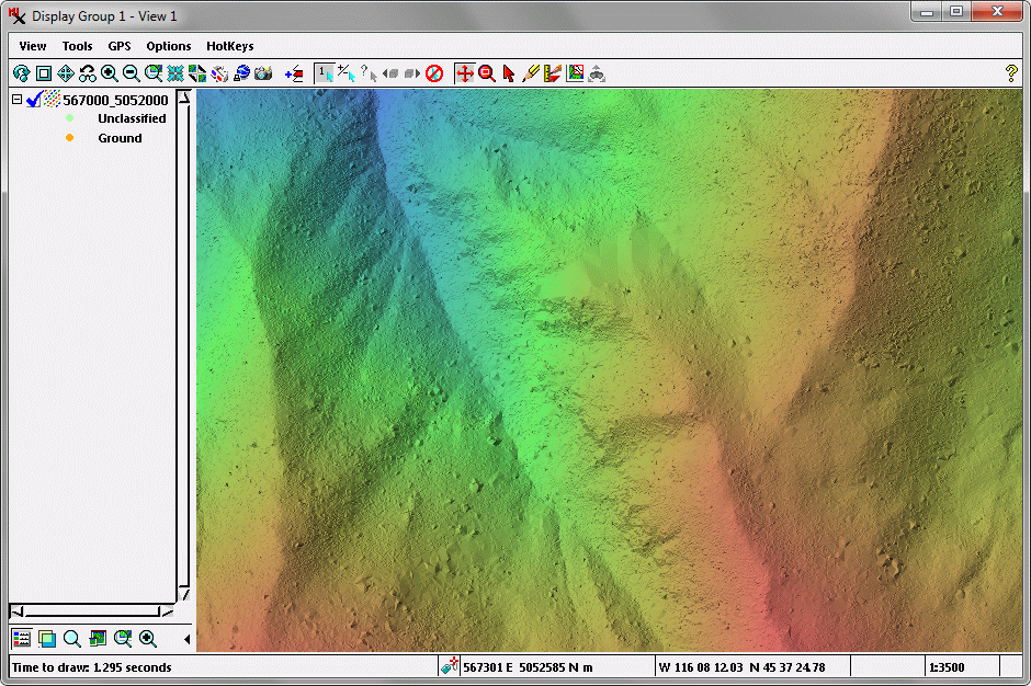
All Points — Color & Relief Shading
Virtual terrain surface from LIDAR points of all classes, shown with a combination of relief shading and elevation color. The virtual surface includes buildings, trees, and a highway overpass.
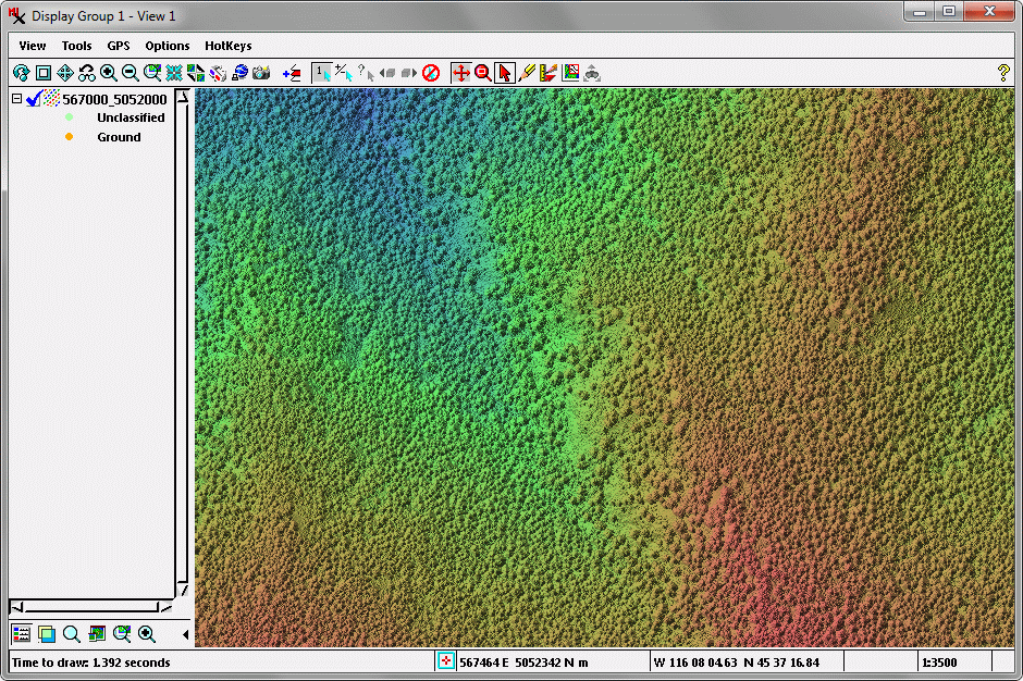
Ground Points Only— Color & Relief Shading
Virtual terrain surface from LIDAR ground points only, shown with a combination of relief shading and elevation color.