Online Maps — Interactive Web Applications

A geomashup can be the starting point for a web application that uses your geodata to present dynamic visualizations that can be varied and controlled by the user. MicroImages has developed several sample web applications that use web terrain tilesets, which contain tiled elevation data. These applications use JavaScript and HTML5 methods to access and process the numerical elevation data in the web terrain tilesets and use it to produce visualizations that can be modified interactively by the user.
Click icons below map to open geomashups with:
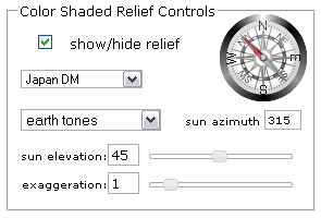
Interactive Shaded Relief
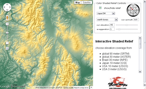
Choose your elevation coverage from:
- global 90 meter (SRTM)
- global 30 meter (ASTER)
- Brazil 30 meter (INPE)
- USA 30 meter (USGS)
- Japan 10 meter (GSI)
- USA 10 meter (USGS)
- Iowa 3 meter (IDNR)
- N Carolina 3 meter (USGS)
- W Virginia 3 meter (USGS)
- Louisiana 3 meter (USGS)
- Pennsylvania 1 meter (PASDA)
Design your own shaded relief map
This sample application demonstrates the use of web terrain tilesets of various resolutions that have been prepared in TNTmips. The application fetches the terrain tiles for the current view from this web site. The application then computes and displays the shaded relief within your browser using only HTML5 and JavaScript. If you change the sun azimuth, sun elevation, vertical exaggeration, or color palette, your new shaded relief view is computed from the same elevation tiles that have already been cached locally. In summary, the shaded relief viewed in this application is recomputed on the fly in your browser and is not precomputed or computed by the server.
Stereoscopic 3D Viewer
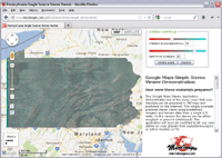

2012 Pennsylvania 1-meter image with 1-foot Terrain Model
MicroImages has developed several Stereoscopic 3D Viewer applications that use elevation data in a web terrain tileset to create stereoscopic 3D views of standard web tileset overlays in a Google Maps geomashup. The applications allow the user to adjust the stereo viewing settings and choose a stereo viewing mode: anaglyph glasses, passive 3D TV or monitor, autostereoscopic 3D TV or monitor, or active (shutter glasses) 3D TV or monitor. You can use TNTmips to prepare your own data for viewing in Google Maps in stereo.
More stereoscopic 3D viewer examples ...