Multilayer Map Display
TNTmips and TNTview can overlay numerous types of geodata in multiple layers.
Geometric Layers
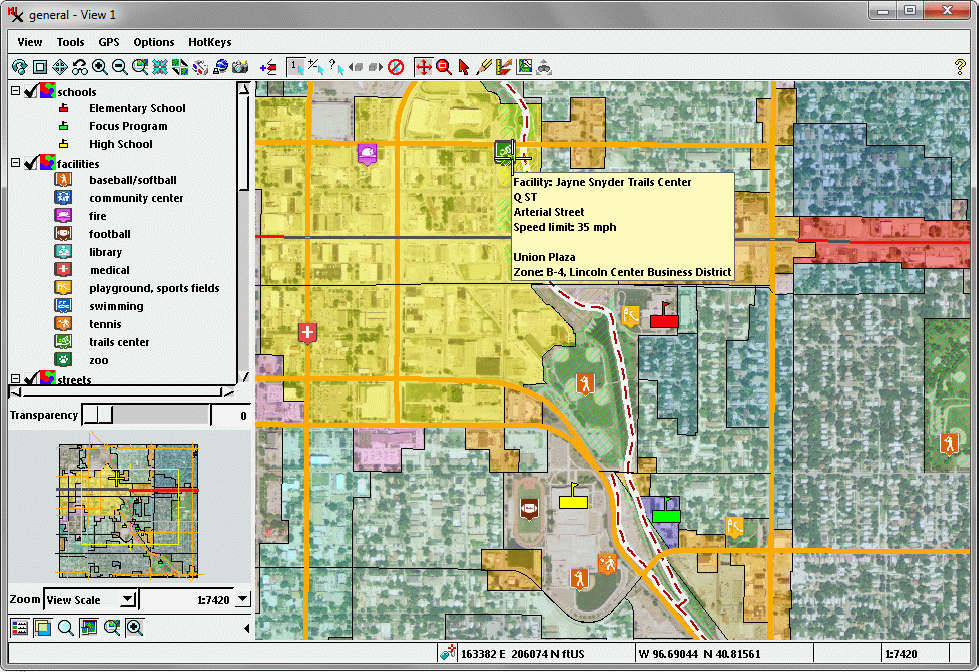
Multiple geometric layers including zoning districts, streets, trails, public facilities, and schools are shown in this View over a color orthoimage. View location-specific attribute information from multiple layers in pop-in DataTips (yellow box).
Groundwater
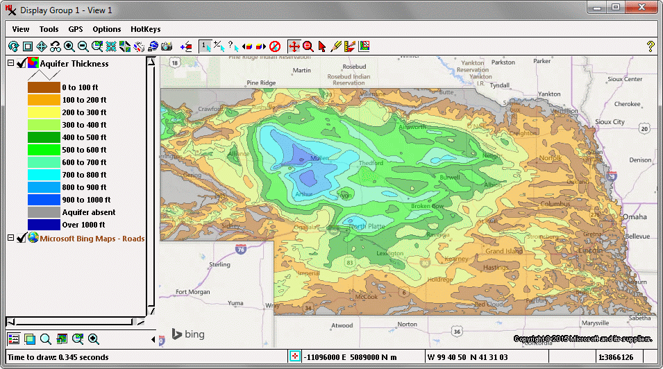
Polygon colors in this View represent areas with different ranges of thickness of the principal groundwater aquifer underlying the state of Nebraska, USA. The base layer for the display of aquifer data is the Bing Maps Roads web layer that is available for use in the TNTgis professional products.
Nebraska USA Counties
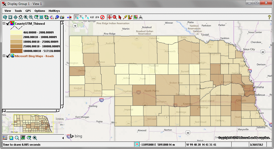
Differing ranges of 2010 population for Nebraska counties are shown in this five-class theme map displayed with partial transparency over the Bing Maps Roads layer that is available for use in the TNTgis professional products.
Geologic Fault Lines
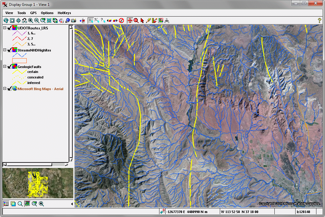
This View shows stream lines (blue) and geologic fault lines (yellow) in southern Utah, USA, with an aerial image background provided by the Bing Maps Aerial web layer that is available for use in the TNTgis professional products.
Bedrock Geologic Map
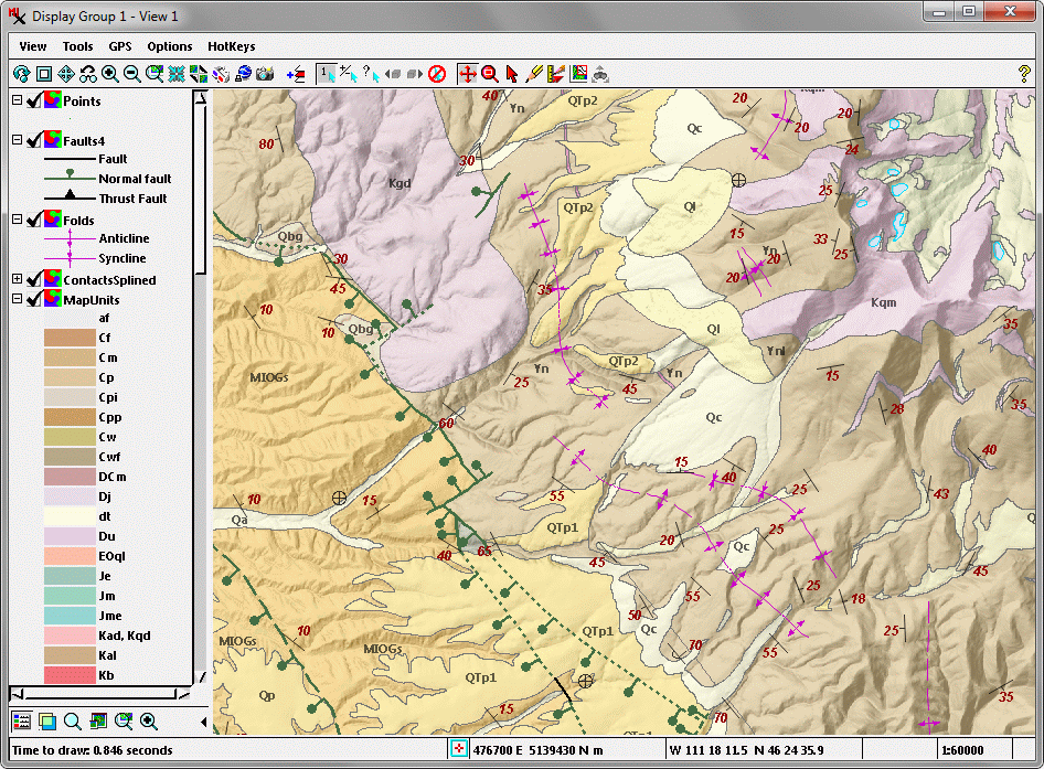
This View displays multiple layers comprising a bedrock geologic map. The map unit layer is displayed with partial transparency over a shaded-relief background to provide important topographic context. Structural elements such as folds, faults, and strike-dip measurements with custom symbols are drawn using CartoScripts with parameters set specifically for the design scale of this map.
Land Cover Types
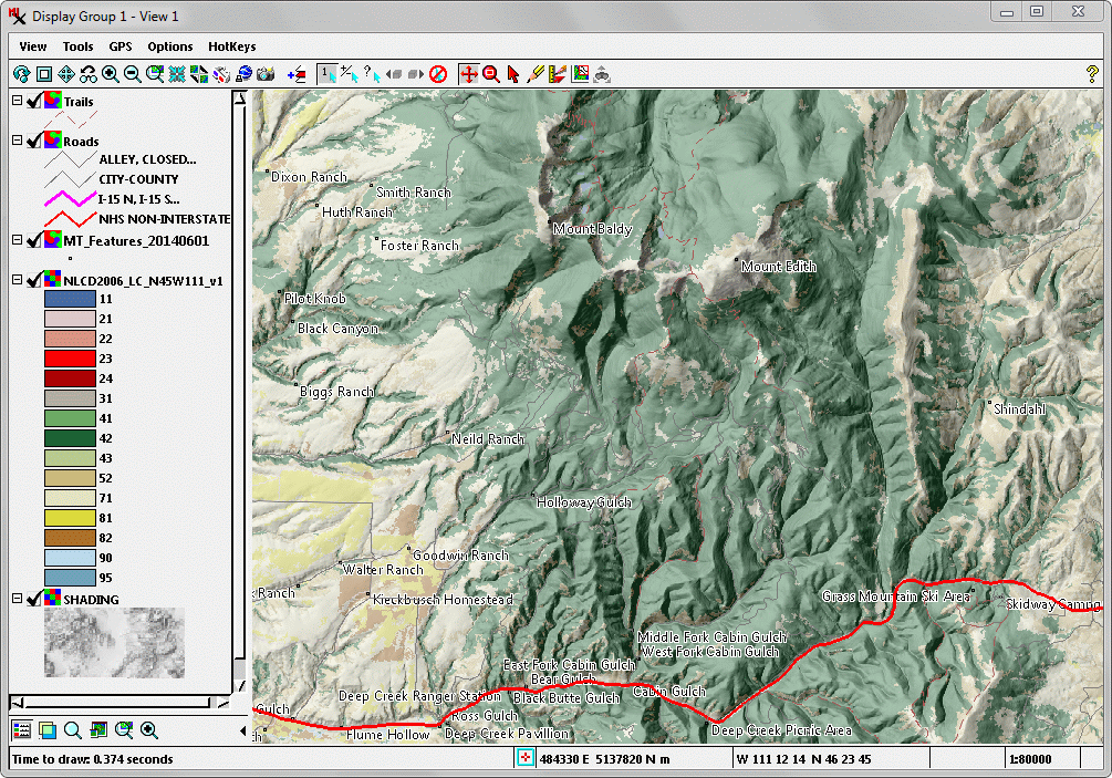
Area colors in this View indicate different land cover types stored as cell values in a raster object. This raster is rendered with partial transparency to allow an underlying relief shading raster object to provide topographic context. Geometric object overlays show roads, trails, and point locations of geographic features (the later with dynamic labels sourced from attributes in the point database).