Print Layout Gallery
Maps and layouts created in TNTmips.
Granite Gulch Geologic Map
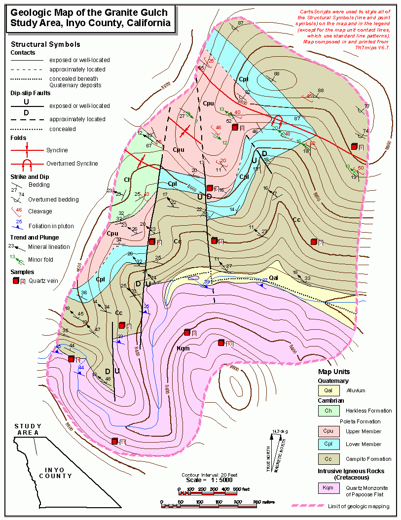
A geologic map of a small area with many custom styles for structural symbols (fold and fault lines and point symbols for structural measurements) set by CartoScripts. Sample elements for each layer rendered by CartoScript were added to the sidebar legend in the View window so they could be incorporated into the multi-object legend in the print layout.
Parkway Zoning Map
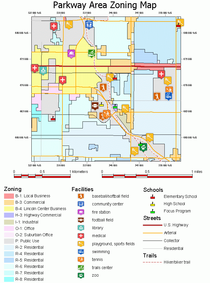
Map of a small urban area showing zoning districts, streets, trails, schools, and other public facilities. The multi-object legend includes entries for the styles in all of these layers. This map uses data provided in the PARKWAY sample data set.
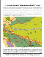
Midway Valley Geologic Map
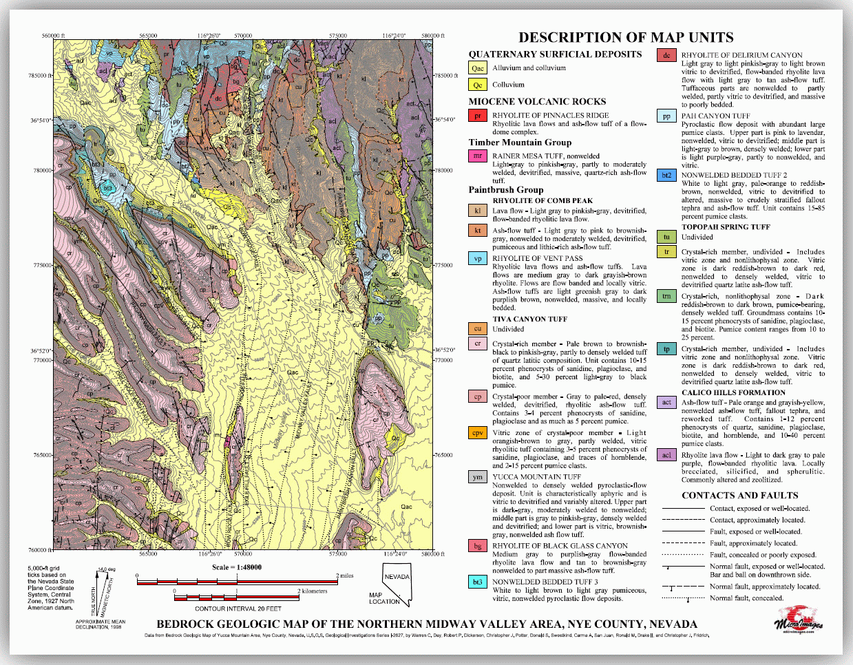
A bedrock geologic map of an area with complex geology in Nevada, USA. The multi-object legend provides full descriptions of the map units as well as for the line symbols used for the unit contacts and faults.
Elevation and Hydrology Map
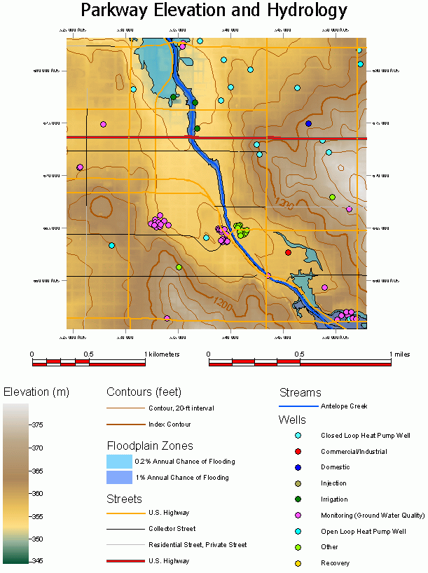
Map of a small urban area with elevation depicted by color and by contours, and several vector layers showing hydrologic features (streams, floodplain zones, and locations of different types of water wells). Streets are included as a reference layer. All of the layers are represented in the multi-object legend, including a continuous color-scale legend for the elevation raster layer.
Topographic Map Layout
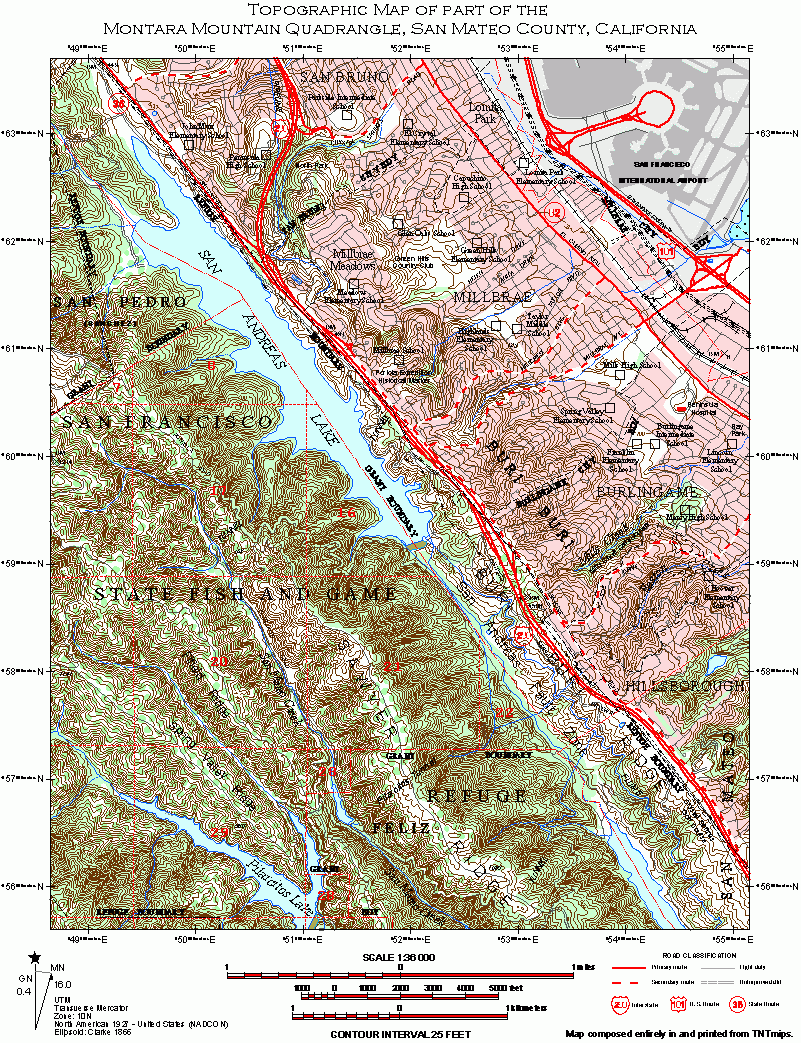
A topographic map that includes both urban and undeveloped areas. Topography is indicated by elevation contours with line labels for the index contours as well as elevation benchmark locations. Additional reference layers include vegetation types, built areas, transportation layers (roads, highways, railroads), and municipal and public lands boundaries with labels. The map includes scale bars, a map grid, and a magnetic declination graphic (rendered by a script).