Interactive Feature Mapping
The unique Feature Mapping process in TNTmips couples your visual interpretive skills with automatic image analysis operations. Using Feature Mapping's interactive tools, you can analyize any number of bands to identify, mark, and measure feature classes.
Feature Mapping
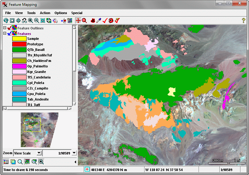
Partial feature map of rock exposures in a desert region in eastern California, USA.