TNTmips provides a complete set of tools for publishing geodata in print or electronic form. You can create hardcopy map layouts with legends, scalebars, grids, and other annotation, then print the layout or render it to PDF or KML. You can assemble any number of layers of image and map data in an electronic atlas that can be distributed on a CD or DVD and viewed in the free TNTatlas software. TNTmips can also convert your image and map data to web tilesets that can be viewed on the web in Google Maps, Bing Maps, Open Layers, or Google Earth in web pages you design in the Assemble Geomashup process.
See also:
Tutorial on Printing
Tech Guides on Geomedia Publishing and
Publishing Web Maps.
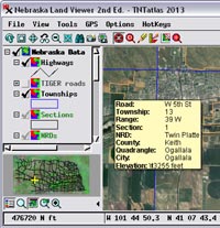
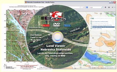
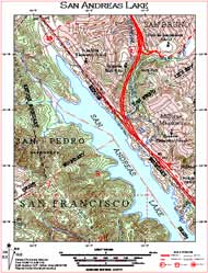
DVD atlas viewed in free TNTatlas
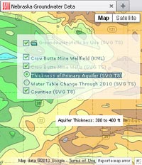
Web geomashup of map data
Map Design Highlights
- Design hardcopy layouts with any number of map and image layers in any coordinate reference systems
- Create complex map legends, add map grids in one or more projections, and add multiple scale bars to hardcopy layouts
- Create electronic atlases that open automatically from DVD or CD
- Atlas layers include all original styling and attributes, and designated attributes are shown in mouse-over DataTips in TNTatlas
- Make zoom-controlled atlases with layers that turn on/off based on current view scale
- Make atlases with hyperlinks to additional map layouts, external data files, or web sites
- Add custom tools designed to allow users to explore the geodata properties
- Synchronize TNTatlas view with Google Earth
- Create tilesets to present image or map data of any size area at any scale in a web browser
- Create standard web tilesets from imagery and SVG or KML geometric tilesets from styled vector map data
- Pop-in info balloons present map attribute information for geometric tilesets
- Use Assemble Geomashup process to design web pages to display your geodata in Google Maps, Open Layers, Bing Maps, or Google Earth
- Overlay tilesets, KML files, and Google Fusion Tables on reference base maps and imagery in geomashups
- Set up geomashup layer controls to allow selection of independent and mutually-exclusive overlays, and organize overlays in groups
- Design geomashup sidebar with layer controls, custom text, and logo
- Geomashup legends for geometric tilesets adjust automatically for view content
- Use interactive query to highlight map elements with selected attributes
- Include drawing/measurement tools that can save annotations as KML
- Use geospatial scripts in interactive web applications for plan review services and geodata provisioning