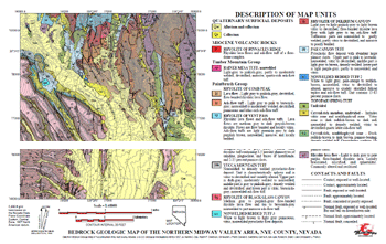
Portions of a geologic map layout prepared in TNTmips
TNTgis includes a full suite of interactive map design tools to aid you in styling and layout for maps of any type, complexity, and map scale. Interactive layout tools let you add map grids, automatic scale bars, legends, annotation text, and index maps with fine control over the positioning of each element in the layout. Maps can be designed for hardcopy printing, electronic delivery as an atlas, or both. Hardcopy layouts also can be rendered to PDF for easy electronic distribution. Complex map design can be accomplished in TNTmips, TNTedit, and TNTview.
See also:
Tech Guides on Map Design,
Map Layouts tutorial, and
discipline-specific Map tutorials.
Scale bars using different units
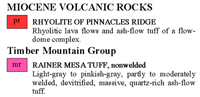
Detailed legends for maps
Continuous color scale and color scale range legends for raster layers
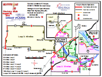
Complex map layout rendered to PDF
Map Design Highlights
- Design layouts for electronic atlases to be viewed at any scale or fixed-scale hardcopy layouts
- Overlay map and image components in any number of coordinate reference systems to match a target reference system
- Incorporate any combination of raster, vector, shape, CAD, TIN, terrain, and pin map layers in one or more logical groups for your map
- Include layers in a wide variety of external formats without importing (e.g., JP2, MrSID, GeoTIFF, shapefile, DGN, DXF, geodatabases)
- Include map and image components published on the Internet as web tilesets or by a Web Map Service (WMS) and/or ArcIMS
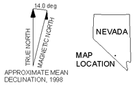
- Add map grids in one or more projections with control over coordinate display format
- Add scale bars that automatically adjust to changes in map scale
- Add multiple scale bars using different units, with full control over bar length, intervals, and labels
- Add complex legends for multiple layers with automated generation of style samples and full control over sample size, text styles, and legend layout
- Incorporate index maps and detailed map insets at appropriate scales
- Attach layout components to the page or to other components and precisely position each component
- Use geographic attachment to organize many layers into logical groups and still obtain precise geographic overlay
- Incorporate 3D perspective groups and anaglyph stereo images
- Apply borders, background colors, and drop-shadows to layout components
- Interactively scale logos and other nongeoreferenced objects
- Create templates for use with maps in a series
- Render complete complex map layouts to PDF with embedded georeference