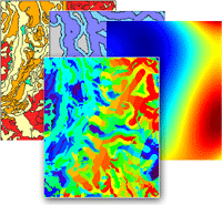
TNTmips is a full-featured Geographic Information System that integrates display and processing of map data, imagery, and terrain data along with the creation and management of associated relational databases. This advanced GIS software provides the tools needed to prepare, analyze, interpret, and publish any type of geospatial data. Using TNTmips you can take on projects in agricultural management, environmental monitoring, mineral exploration, wildlife management, disaster relief, land stewardship, archaeology, site planning, and many other application areas.
See also:
Geographic Information Systems (GIS) tutorial.
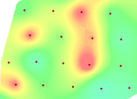
Interpolate surface from point data
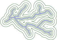
Compute buffer zones
Multi-Criteria Decision Analysis
Logical combination operations
GIS Highlights
- Use local and web data, aerial and satellite imagery, map data, terrain data, LIDAR, and enterprise databases (MySQL, PostgreSQL, SQL server, Oracle)
- No size or element count limits on spatial objects
- Display any number of data layers with different coordinate reference systems with automatic reprojection to match a target reference system
- Support for hundreds of predefined coordinate reference systems or define your own
- Use geodata in many file formats immediately without import or conversion
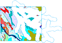
- Create, edit, and process geodata in raster, vector, CAD, shape, and TIN structures
- GeoToolbox provides multi-purpose drawing tools for measuring, sketching and annotation, and creating region objects for data processing
- Interactive Query Builder makes it easy to construct database queries to highlight and select map elements using any combination of attributes
- Perform logical combination operations (intersect, union, exclusive union, subtract, add) with map data layers
- Generate buffer zones, grids, sample points, polygons fit to points, and Voronoi diagrams from map data
- Compute and attach 2D or 3D statistical properties for map polygons from a raster object, point data, or another set of map polygons
- Create theme maps with sets of styles for points, lines, or polygons automatically generated from numerical attributes
- Full suite of image enhancement, classification, and interpretation tools
- Construct and transform terrain data as points, triangular irregular networks (TINS), contours, and Digital Elevation Model rasters
- Compute viewsheds, watersheds, cut and fill analysis, and path analysis from DEMs of any size
- Unique GeoFormula process facilitates custom combinations of any types of geospatial data, such as multi-criteria decision analysis
- Automated region generation via buffer zone, cluster and polygon fitting, flood zone, basin, and viewshed operations