Color Binarization
V5.40 –– July 1996
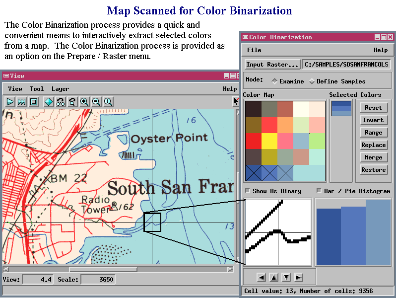
The Color Binarization process in TNTmips (Prepare / Raster / Color Binarization) creates binary rasters using colors you select off the screen from the display of a raster object (as illustrated above). By working with different colors, you can create several different binary rasters that pull out different features from the source map.
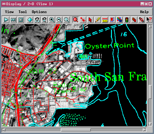
The next illustration shows a SPOT image overlaid with three separate binary rasters created by Color Binarization. The null value in each binary raster is set to be transparent in the display process so that only the extracted features of interest overlay the base image: blue bathymetric features, red roads, and green for railroads, pipelines, and other annotations.
Color Binarization is a quick way to prepare binary raster overlays from scanned maps (as in the example above). The process can also be used as a step in raster-to-vector conversion projects. The binary raster output can be thinned (Prepare / Raster / Thin Lines) and then automatically converted to line and polygon elements in a vector object (Prepare / Convert / Raster to Vector / Auto Lines).