Geomashups: Image Web Tilesets for Plan Reviews
Geomashups of image tilesets are a great way to present planning documents for public works projects on the web for review and comment by the public. Geomashups present planning maps in full geographic context and allow examination of the maps, plans, and images at any desired range of scales.
Highway Interchange Project, Modesto, California
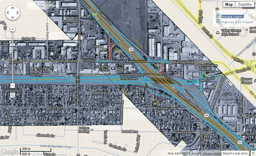
These geomashups present preliminary plans for a proposed redesign and relocation of a highway interchange in Modesto, California. Raster images of the maps and plans were captured from a PDF file and converted to image web tilesets in TNTmips. Three image tilesets were created with different zoom level ranges. A vicinity map shows the regional context, a location map is shown at intermediate zoom levels, and detailed plans with the highway configuration over a grayscale image background are shown when zoomed in. The Assemble Geomashup process in TNTmips was used to select the three tilesets and set them to be presented as a single layer in the web browser.
South Beltway Project, Lincoln, Nebraska
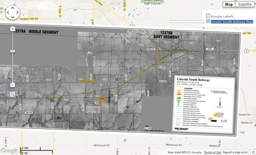
A planning map for a proposed beltway project around the south side of Lincoln, Nebraska is shown in these geomashups. The source planning map has a grayscale image base with color overlays showing the proposed beltway route, resulting changes in existing infrastructure, and other associated features. The map image was captured from a PDF file and converted to an image web tileset in TNTmips. In the Google Maps geomashup the layer controls are provided with a transparency slider allowing the viewer to make the planning map partially transparent over the selected base map or image.