Online Maps — Geomashup Design Features

The Assemble Geomashup process in TNTmips offers a variety of design possibilities when you create a geomashup. You can choose to have the layer controls "floating" over the map or included in a sidebar on either side of the mashup. Using a sidebar also allows you to include custom text to accompany the geomashup and to include a logo. In Google Maps or Open Layers geomashups you can also choose to include drawing or measurement tools for viewers' use.
Click icons below map to open geomashups with:
Legends for Geometric Tilesets
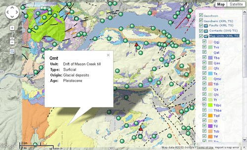
You can include a legend within the geomashup layer controls for any individual geometric layers (SVG and KML tilesets and KML files). The legend is recreated each time the geomashup is loaded, with a legend entry created for each unique style and corresponding attribute value in the source geometric object. Each legend entry includes the attribute name, graphic sample, and a checkbox that allows all elements with that attribute to be toggled on/off. The folder icon for a legend in the geomashup layer controls serves as a hide/show control, and you can specify whether the legend should be initially shown or hidden.
Sidebar for Layer Controls, Text, and Logo
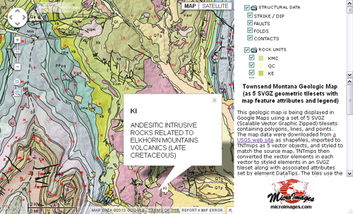
A geomashup can incorporate a sidebar to the right or left of the map, with a width that you can specify in pixels or as a percentage of the window width. A sidebar automatically includes the layer controls and any legends created for geometric layers. In the Assemble Geomashup process you can also enter text to be shown in the sidebar below the layer controls/legends, or provide a link to another HTML file that contains text with desired formatting, links to other documents containing additional information or legends, and so on. You can also provide a link to a logo image to be shown at the bottom of the sidebar.
Drawing and Measurement Tools
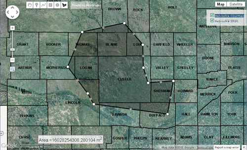
Geomashups created for Google Maps or Open Layers can include optional measurement tools or drawing tools. Measurement tools allow you to place point markers, draw lines (paths), or draw polygons and provide readouts of map coordinates, length, or area, respectively. Drawing tools provide the same drawing capabilities, but you can name and describe each element you draw and save the result as a KML file.