Watershed
Analyze an elevation raster to determine watershed boundaries, stream drainage networks pruned to the desired density, and tributary subcatchments, along with a variety of hydrologic and geomorphic attributes of the streams, catchments, and terrain. The watershed analysis operations have been tuned to work efficiently with even very large elevation rasters. See the Watershed Analysis page for more information.
Stream Network
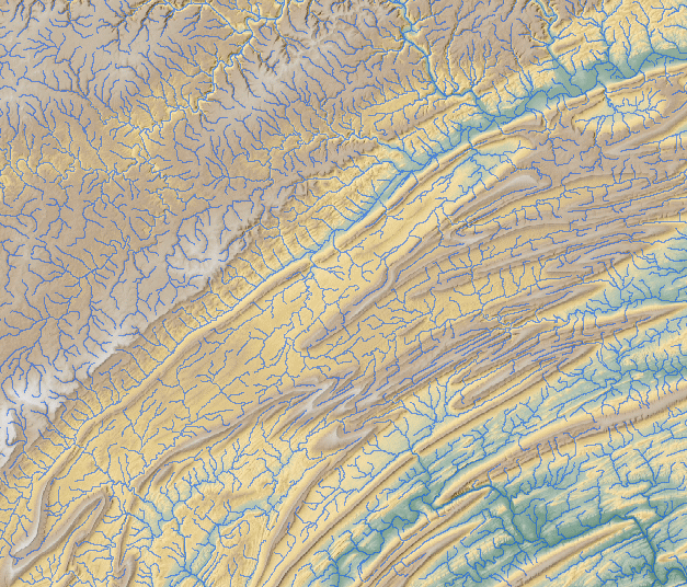
Stream network (blue lines) for a large area in Pennsylvania (USA) computed by the Watershed Analysis process in TNTmips