3D Perspective Display
Use a terrain layer to produce oblique perspective renderings of any images and map data. See the 3D Visualization page for more information.
3D Perspective Display
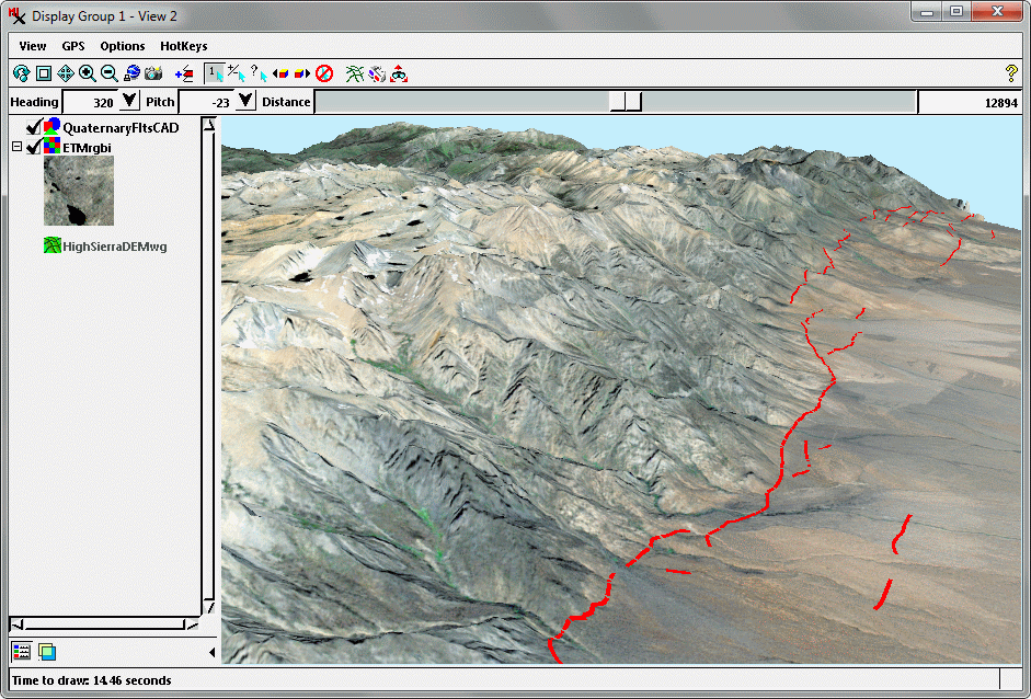
3D perspective display of Landsat image of a mountain front in eastern California, USA with overlay of recently-active geologic faults (red lines).