Stereo Viewing
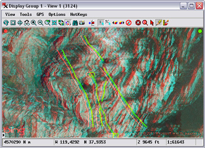
Draw and edit lines in stereo on the terrain
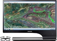
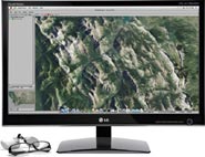
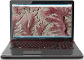
You can see the geospatial data in any View window in the TNTgis software in stereoscopic 3D (stereo) using a terrain layer and any popular stereo viewing device. The TNTgis software supports all of the stereo 3D viewing technologies used in new monitors, laptop screens, TVs, and projectors. Images, tilesets, and map data can all be viewed on the stereo terrain surface, providing a computer view that better replicates your experience with the real 3D world. The drawing tools in all TNTgis processes allow you to draw and edit geometric elements directly on the stereo terrain surface. For applications where terrain is important (geology, engineering, hydrology, mineral exploration, forestry, and many others), you can increase your accuracy and productivity while editing and doing visual analysis by viewing your images and GIS data in stereo.
See also:
Tech Guides on Stereo Viewing.
active stereo
passive stereo
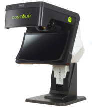
Contour glasses-free system
glasses-free (autostereoscopic)

anaglyph
Stereo Viewing Highlights
- View any image or standard web tileset in stereoscopic 3D in TNTgis views using an elevation raster object or Web Terrain Tileset
- Create stereo views in Display, Editor, and many other processes in TNTmips
- Toggle stereo display on/off
- Choose stereo display mode to match your viewing device
- Use active stereo monitor or 3D TV (with shutter glasses)
- Use passive (line-interleaved) stereo monitor or TV (with polarizing cinema glasses)
- Use glasses-free (autostereoscopic) monitor or laptop
- Use "Contour" glasses-free system by Vision Engineering
- View stereo on any monitor using inexpensive anaglyph colored glasses
- Vary the relative depth and maximum relief exaggeration of the stereo rendering to suit the terrain being viewed
- Stereo indicators identify left and right stereo renderings in view to allow correction of inverted topography
- Transparent color overlay indicates any image areas not rendered in stereo because they are outside the limit of terrain coverage
- Annotate, GeoToolbox, and Editor drawing tools are automatically rendered on the stereo terrain surface
- 2D vector, CAD, and shape overlays are automatically rendered on the stereo terrain surface
- Use Editor to draw points, lines, and polygons on the terrain and automatically assign 3D coordinates to the elements from the terrain surface
- Specify which of your eyes is dominant to provide more comfortable and accurate drawing in stereo
- Render anaglyph stereo views to raster or print layouts with anaglyph stereo images