Web tilesets are structures specifically designed to allow geospatial data layers of any size and detail to be used efficiently over the internet or your local network. TNTmips Pro can convert your geodata into a tileset in which the data is subdivided into many small, uniformly-sized tiles created over a range of discrete zoom levels. You can use web tilesets to let anyone view imagery, scanned maps, vector map data, and elevation data in a web browser without the need for any special software on your web server. Use the Assemble Geomashup process in TNTmips to design web pages that display your custom data in Google Maps, Bing Maps, Open Layers, or Google Earth.
See also:
Tech Guides on Publishing Web Maps.
Geomashup with image tileset
Geomashup with Fusion Tables
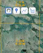
Optional measurement tools
Publish Web Maps Highlights
- Create tilesets to present image or map data of any size area at any scale in a web browser
- Export or mosaic imagery to standard web tilesets with choice of image formats
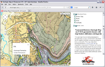
- Create SVG or KML geometric tilesets from styled vector map data
- Create web terrain tilesets from elevation rasters
- Choose range of zoom levels to create in the tileset
- Comprehensive tools for subsetting or merging tilesets
- Interactive process to design geomashup web pages to display your geodata in Google Maps, Open Layers, Bing Maps, or Google Earth
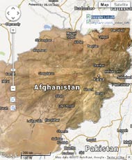
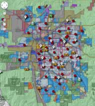
- Overlay tilesets, KML files, and Google Fusion Tables on reference base maps and imagery
- Create Open Layers geomashups using only your own proprietary data for use on your organization's network or for portable offline use
- Choice of geomashup layer controls for independent and mutually-exclusive overlays and overlay groups
- Pop-in info balloons present map attribute information from geometric tilesets
- Geomashup legends for geometric tilesets adjust automatically for view content
- Interactive query to highlight map elements with selected attributes
- Specify zoom level range, starting zoom level, and extents for geomashup
- Design geomashup sidebar with layer controls, custom text, and logo
- Include drawing and measurement tools in geomashup; viewers can save annotations as KML
- Create 3D Collada tilesets to view your custom imagery and terrain in Google Earth