3-D Perspective Features, TNT products V5.6
V5.60 –– April 1997
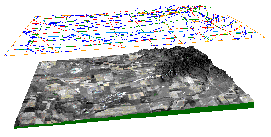
• A 2-D vector object (x, y road line elements) floats at a 2000-foot offset. It takes its 3-D shape from the DEM surface object below.
• A color composite raster object (SPOT XS satellite image) is draped over a 16-bit elevation raster object for the San Francisco North map quadrangle.
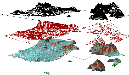
 The TNTmips 3-D
Perspective process supports TIN and 3-D vector display in multi-layer 3-D
views. TIN and 3-D vector objects provide their own elevation information and
are displayed in 3-D without reference to the elevation characteristics of any
surface objects in other layers.
The TNTmips 3-D
Perspective process supports TIN and 3-D vector display in multi-layer 3-D
views. TIN and 3-D vector objects provide their own elevation information and
are displayed in 3-D without reference to the elevation characteristics of any
surface objects in other layers.
2-D vector objects can display in 3-D by taking their elevation information from a surface layer, such as an elevation raster object, elsewhere in the view.
TIN objects, 3-D vector objects, and 2-D vector objects can be drawn in any line style. They can be drawn at the same level as a raster layer, so that their line elements appear to be drawn onto the image features. Alternatively, they can be drawn at a selected z-offset so they float above the other layers in a stacked view.
An automatic contour option is provided in the TIN Object Display Controls window for TIN display. When the contour option is enabled, the process displays the TIN surface with contour isolines drawn at selected intervals. Two interval values can be set and each interval assigned its own drawing style. The illustration below shows a primary contour interval of 50 meters, drawn with a heavy brown line style, and a secondary interval of 10 meters, drawn with a light brown line.