Using Regions in TNT products V5.5
V5.50 –– October 1996
in TNTmips and TNTview
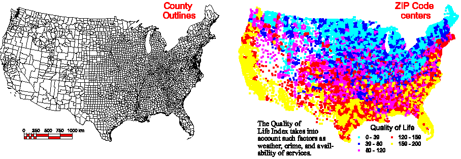
Targeting Well-Educated Counties with a High Quality of Life Index
Regions allow you to select elements in any number of layers based on attributes found in yet another layer of a complex view. This example uses the attributes of one vector object (points identifying ZIP code centers) to select polygons in a second vector object (county outlines).
A region was created using a standard polygon fitting algorithm to derive polygons around points that were selected by query. The query selected points where more than 40% of the population over age 25 had college degrees, and where the EASI Quality of Life Index was greater than 100. The county outlines vector object is shown at left. The ZIP code points are shown at right as a theme map depicting the Quality of Life Index:
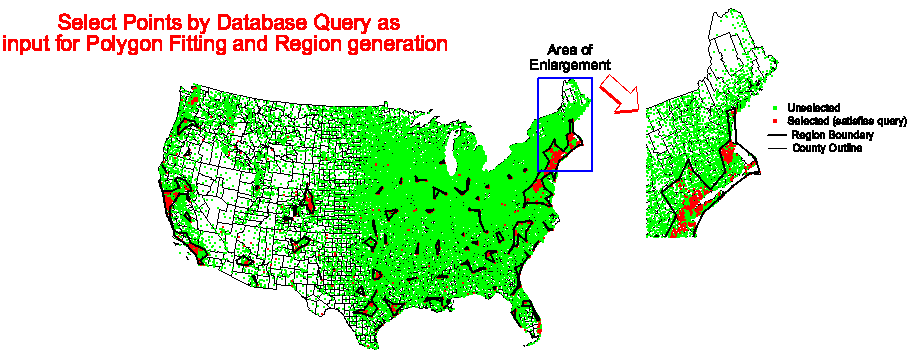
Next, the county outline and ZIP code vector objects are shown in overlay. The drawing style for unselected ZIP code points is solid green circles, while the ZIP code points selected by query are drawn in highlight (red). Blue polygons were drawn around the selected red points with the Create Region feature using one of the automatic polygon fitting methods provided.
Finally, the region created by polygon fitting was used interactively to select counties in the counties vector object: either partially inside the region (left), or completely inside the region (right):
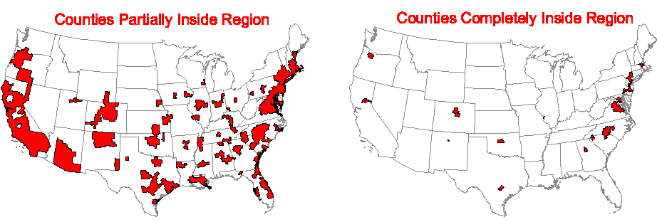
These selected county polygons can also be made into a region for further
selection operations. The USA state outlines are provided for reference.