Surface Modeling in TNT products V5.5
V5.50 –– October 1996
The TNTmips Surface Modeling process can be used to generate surface rasters, vector contours, and TIN objects that represent many types of functional surfaces, such as ground surfaces, groundwater surfaces, ore-bodies, or contaminant plumes.
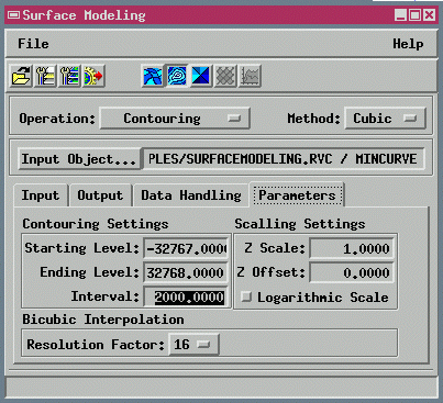
The Surface Modeling operations previously available as a number of separate processes are combined in a single new process (select Interpret / Surface Modeling... from the TNTmips menu). You can consecutively create surface rasters, vector contours, and TIN objects from a variety of source objects. Many new features and model surfaces are presented in a visual and interactive environment so you can compare and evaluate new surface objects immediately.
The Surface Modeling process lets you
- create surface rasters from 3-D vectors, TIN objects, and databases;
- create vector contours from surface rasters or TIN objects; and
- create TIN objects from 3-D vector objects.
The Surface Modeling window is used to select operations, methods, and options for the process.
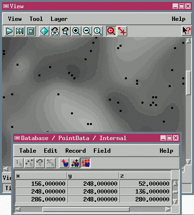
For example, a surface raster can be created from a database containing x, y, and z coordinates that describe spatially located points:
Contours derived from the surface raster and a TIN object created using the vector node elements reflect the versatility of the new, integrated Surface Modeling process:
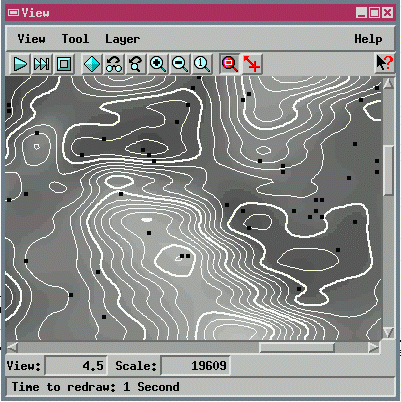
automatic contours generated from surface raster
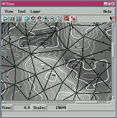
TIN generated from 3D points