EASI data in TNTlite
V5.50 –– October 1996
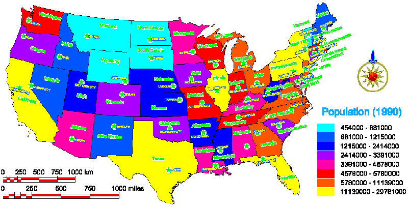
The three maps on this page have themes established using database tables
from the inexpensive EASI Database CD. All of these maps fit within the size
constraints established for TNTlite. The outline map of the continental United
States has general population data for each state (S_genpop) related to state
polygons by the state names in another table associated with the vector
object. The capital cities on this map are vector points extracted from the
imported general population data for US cities with populations greater than
5000 (Y_genpop). The theme used for map coloration was determined by the 1990
state population as presented in the general population table (S_genpop),
which was copied to the polygon database of the state outlines vector object.
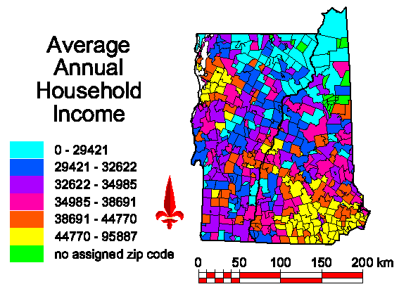
The vector object used for the Average Household Income map was initially created by merging ZIP code outlines for Vermont and New Hampshire. The detailed income by zip code database (Z_inc) provides the avenge household income information used for the theme. The Vermont /New Hampshire state outlines (extracted from the full United States) are also a layer in this group.
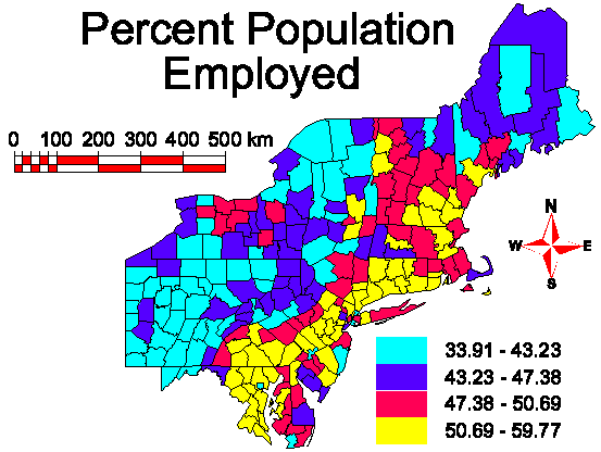
A county outline map for the northeastern region of the United States uses a computed field added to the employment and industry table (C_empl) imported from EASI to establish the theme for Percent Population Employed.
State and county vector outlines are provided as sample data on the TNT products V5.50 CD-ROM.