The TNT Interface for Creating Regions from EASI Data
V5.50 –– October 1996
This page reviews the TNT interface modifications introduced with V5.5 that support the use of coordinate data from a TNT database object for the creation of a Region of Interest polygon.
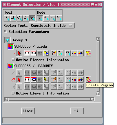
Creating and using regions begins with the Element Selection window (in TNTmips' Display or Edit, or in TNTview). You can use the tools in this window to select elements, use the tabular database display to select elements with designated attributes, or use a query to select elements.
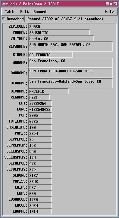
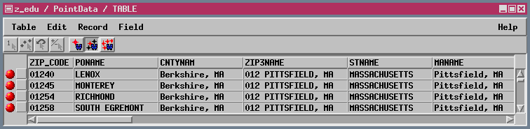
A single record view of the table attached to the ZIP code points imported from an EASI database is shown above; a tabular view of the same database is shown below:
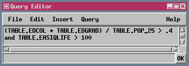
The Element Selection window at the top of this page was captured after points were selected by query and used to generate a region by Polygon Fitting. That region was used to select counties. (The settings illustrated select counties completely within the region). The query that selected the points used as input for region creation by Polygon Fitting is shown in the Query Editor window:
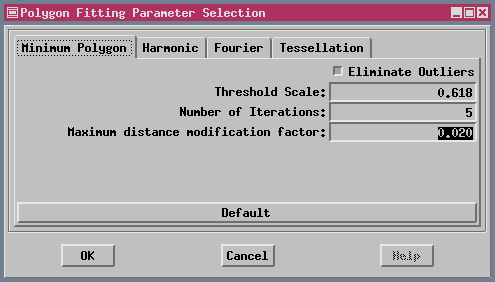
After points are selected, you can choose to create a region by fitting polygons to the selected points using one of the four Polygon Fitting algorithms. The parameters used to generate polygons with an empirically good fit in this example are shown in the next window:
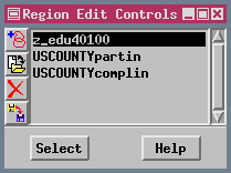
You need to change to the Region Tool (at the top of the Element Selection window) to see your Polygon Fitting results. Once a region is generated and the Region Tool is active, the region can be used for selection of elements in all layers by clicking the right mouse button with the cursor in the View window, or clicking on the Select button in the Region Edit Controls window: