Distance Rasters
V5.40 –– July 1996
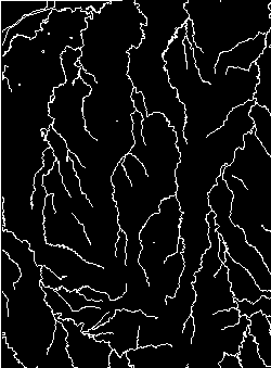
binary input raster |
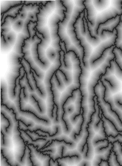
output distance raster |
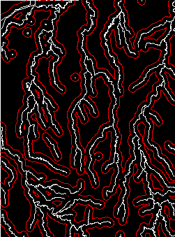
derived vector contours |
TNTmips V5.4 introduced a new Raster Distances process (Interpret / Raster / Distances). The process analyzes an input raster and creates an output distance raster in which each cell contains the distance to the nearest binary feature in the input raster. The distance raster can be thought of as a continuous surface: low values are close to the input features, and high values are farther away.
As a surface, the distance raster yields itself to further manipulations, such as contour tracing (Prepare / Convert / Raster to Vector / Contours). Contours derived this way essentially define vector buffer zones around the original binary input features.
In the illustration above, a binary network of hydrology from the Crow Butte map quadrangle in western Nebraska is used for sample input. The center image shows the output distance raster that contains cell values indicating the distance to the nearest white drainage feature. The third image shows a buffer zone vector object (in red) traced from the distance raster.
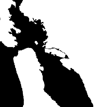
Distance values in the output raster may be computed to black, to white, or to both kinds of binary input feature. The illustrations above show distances computed only to white input features. For input that contains large-extent features of both black and white, such as a lake region with black lakes and white land, you may want to compute the distance to the feature boundaries (shorelines) from both directions. In this illustration, values in the black regions indicate distance to the nearest white feature, while values in the white regions indicate the shortest distance to a black feature.
 |
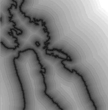 |
| binary land / water input | distance "to both" output |
The distance raster may be used to generate large sets of nested vector contour lines, as illustrated above, or it could be used in raster GIS processes. For example, as a one of many processing rasters in Feature Mapping (Interpret / Raster / Classify), the distance raster would influence classification outcomes based on spatial proximity to the original binary features.