Theme Mapping
V5.30 March 1996
The Theme Mapping features in TNTmips are built in to the 2-D Display process (Display / 2-D...). Any attribute in a database table associated with a vector, CAD, or TIN object can provide the basis for a theme.
The following illustration shows a county map of California with a related database that contains 1994 county populations estimated by the National Center for Geographic Information and Analysis. The counties map was imported from an ARC/INFO coverage file. TNTmips computed a Population Density field = Population / SquareKm.
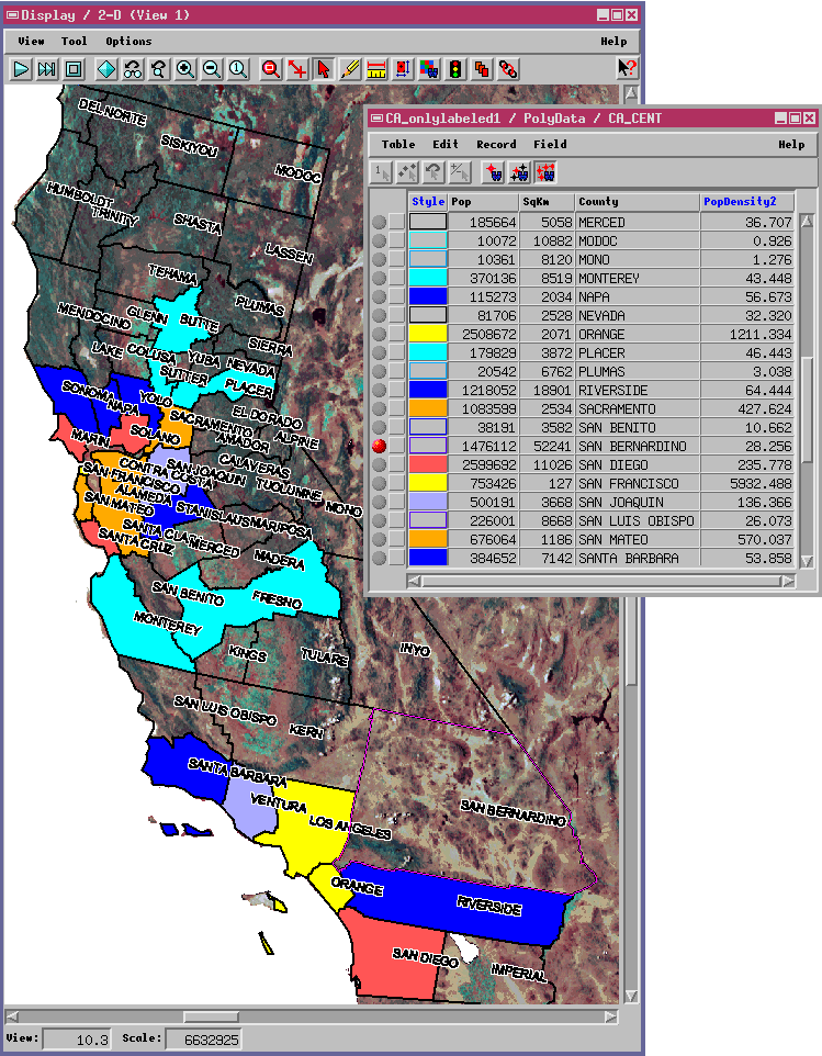
California Population Density
The county polygons with population densities less than 40 persons per square kilometer are drawn in outline only. The other counties are drawn with fill color automatically selected from a user-defined color spread (cyan to yellow) according to population density. The San Bernardino county polygon has been selected by the user, and its associated record in the database window is flagged.
The base image is imported from AVHRR.